Drone Surveying and Aerial Mapping
The possibilities with drone aerial surveying and mapping are endless.
The possibilities with drone aerial surveying and mapping are endless.
Ferguson Perry provides professional aerial drone surveying, mapping, video and remote inspection capabilities to the the Wimmera Mallee and Western Victoria regions. Our aerial mapping services offers flexibility in working on many applications through the use of our fixed wing and multi-rotor RPAS (Remotely Piloted Aircraft System) and the latest capability software.
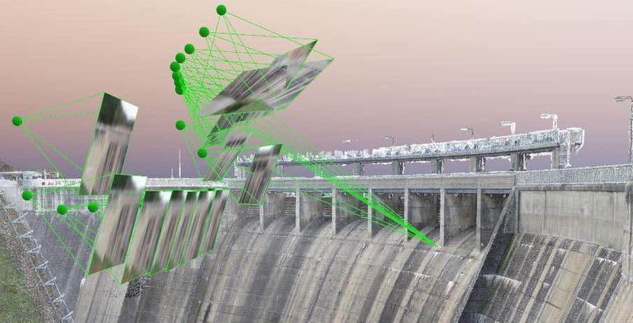
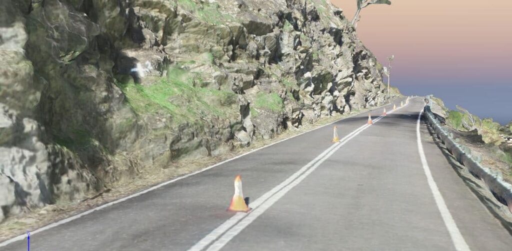
Ferguson Perry can create up-to-date high resolution geo-referenced aerial images of your site. From the high level of information obtained from the aerial photography, Ferguson Perry utilises the latest software to extract high-quality products to suit your application, ranging from 3D point clouds, 3D models and textured meshes, orthomosaics, terrain models, contour plans and volumetric details.
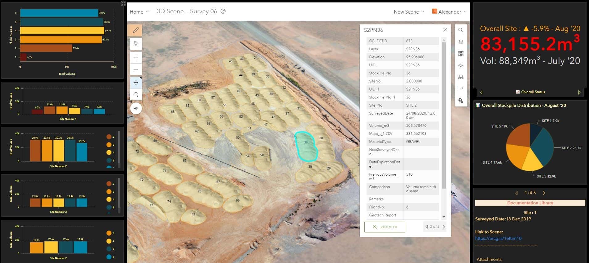
Along with the Ferguson Perry Offsite 360 application, cloud based web application viewers and stockpile management GIS web application, our RPAS operations are set up to provide an end-to- end service that allows our clients to easily interact with highly informative data sets anywhere, anytime online.
As all work is undertaken by surveyors, you can be assured that the information is accurate and validated. Our team hold CASA accredited remote pilots qualifications. Operating under a chief pilot and a CASA certified remote operators’ certificate (ReOC), Ferguson Perry ensures safe operations can be conducted whilst achieving your goals.
RPAS drone surveying
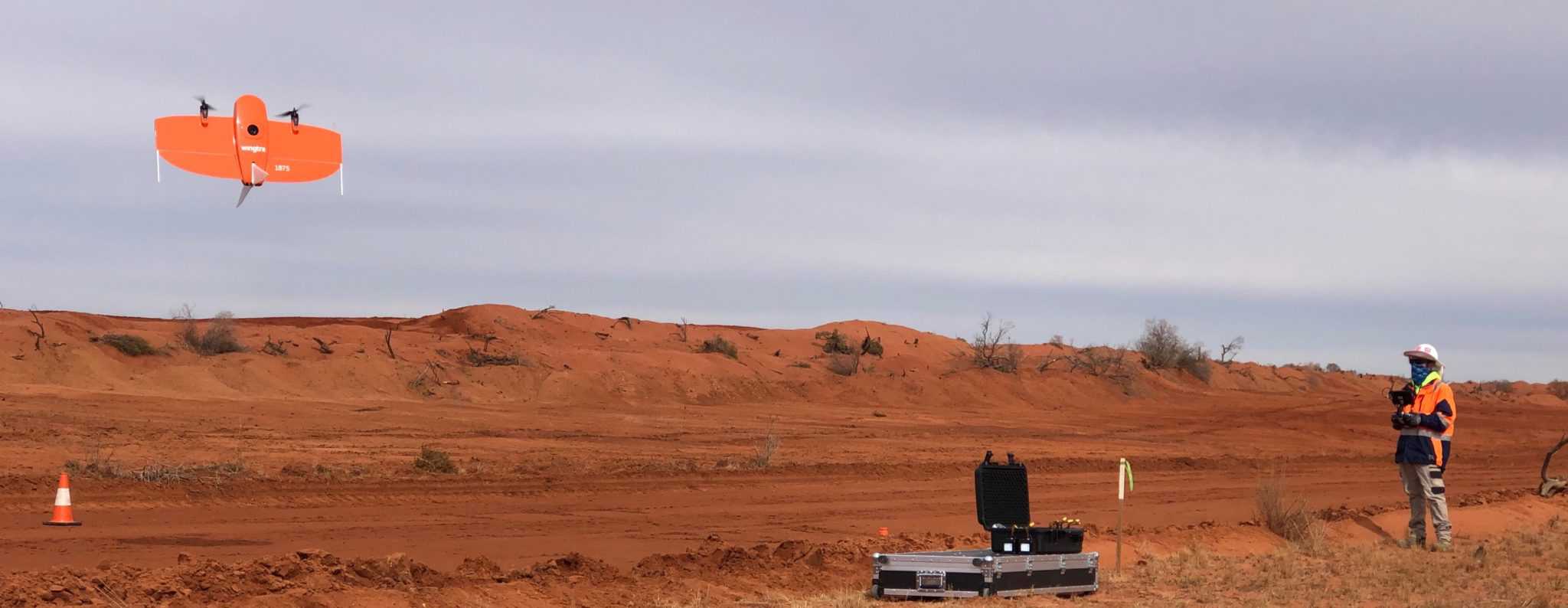
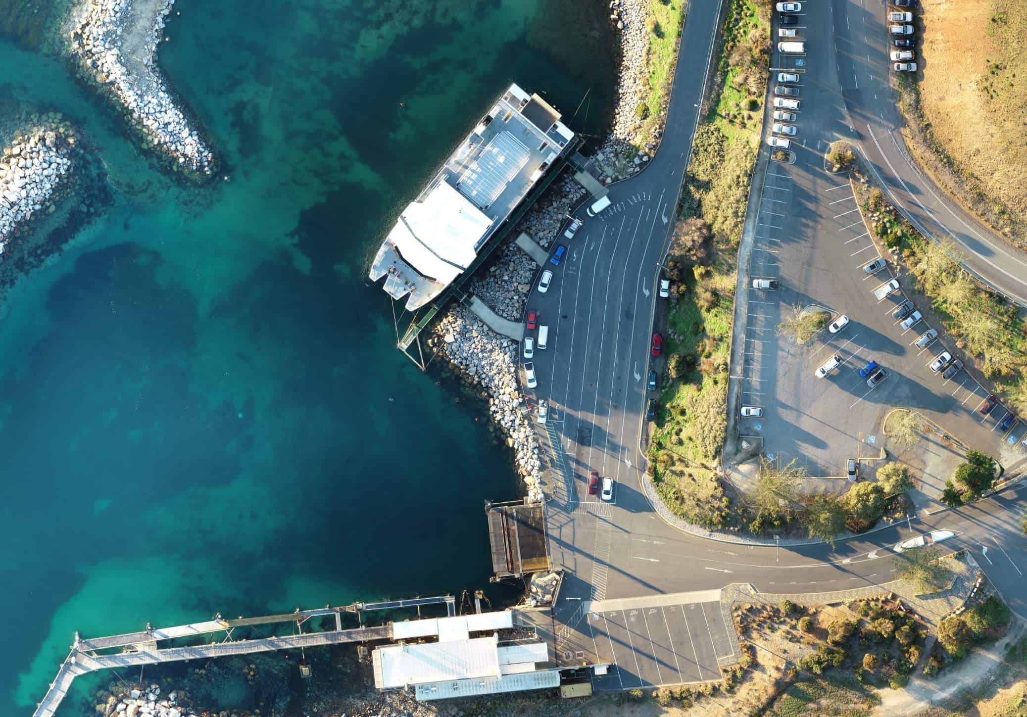
Drone mapping is a fast, safe and accurate way to gather data. Using RPAS we can access areas at much lower altitudes than satellite and aerial mapping, making the collection of high resolution images a much faster process. This technology allows us to gather data in areas that are difficult or unsafe to access, without putting your team or ours at risk. This non-intrusive method can be completed within a single day, accelerating your project’s timeline.
Applications for remotely piloted aircraft in surveying stretch across a variety of industries including; mining, engineering, architectural, environmental, land development, renewable energy and more. Ferguson Perry has the qualifications and expertise to service your project across any sector. Our team of surveyors can validate survey accuracies, compile progress reports and spatially visualise your project in real-time using RPAS units.
Measure your engineering projects and manage operational construction sites using aerial data. Ferguson Perry can conduct assessment surveys, condition monitoring, stockpile monitoring, progress tracking and, as-builts for infrastructure projects using aerial topographic mapping.
We can complete the surveys safely and with no interruption to business operations and deliver rich, accurate 3D spatial data sets.
Increase the accuracy and efficiency of your architectural project planning with our UAV survey services. Gather accurate real-time data for visual assessments and surface measurements using drone technology. Safe and accessible site surveying for urban and built up areas.
Survey hard to access or large expanses of land using our aerial mapping services. Our drone technology simplifies environmental monitoring, vegetation assessment and coastal management.
Quickly and easily compile accurate and comprehensive data with a single flight. Using our 3D mapping software, we can obtain volumetric measurements to calculate stocks for inventory and monitoring purposes. Suitable for mine planning and open pit surveys and inspections.
Use aerial mapping for all stages of land development from concept and subdivision planning through to construction assessment and photography. Highlight boundaries, air-flight paths, line-of- sight visualisations, and geographical notions used in planning and pre-construction studies.
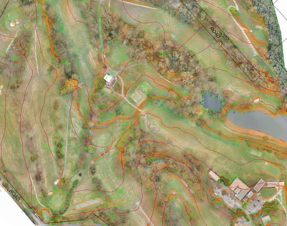
Modify your GIS framework and analysis with aerial mapping. We can extract accurate slope measurements and ground acclivities used for project planning and risk assessment. Analyse terrain models and location resources to measure the viability of a proposed build site.
Provide accurate data on property boundaries and GIS data for asset management and town planning. Revisit the site virtually using previously collected data.
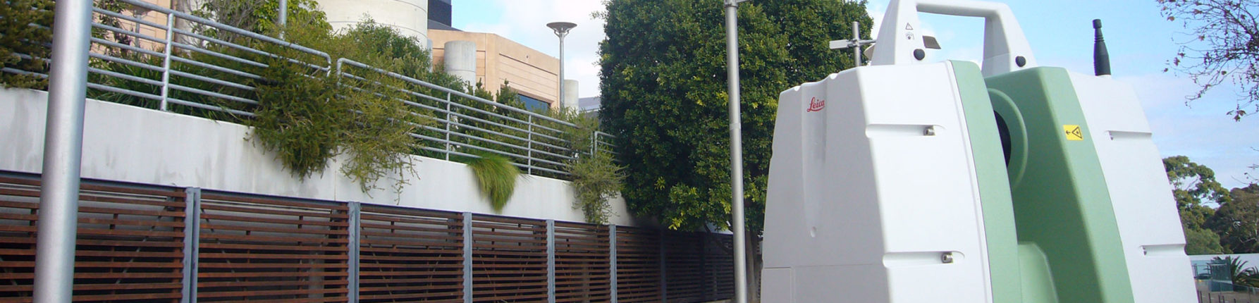
We’ll ensure your laser scanning project is delivered as efficiently and effectively as possible.
Every project is unique, and we adapt our solutions to suit. We’ll work with you to understand your objectives, identify risks and build the best solution. Our work is certified to an international standard so you can feel confident in the results.
THE POSSIBILITIES WITH DRONE AERIAL SURVEYING ARE ENDLESS.
Contact the specialist team at Ferguson Perry Surveying to discuss your requirements.
Contact Us