Boundary & Feature Surveys
Ferguson Perry Surveying provides a range of boundary and feature survey solutions to help you get the right information before you begin your next project.

Ferguson Perry Surveying provides a range of boundary and feature survey solutions to help you get the right information before you begin your next project.

We provide a range of boundary and feature survey solutions to help you get the right information before you create an easement, build a new fence, subdivide or start construction, saving you costly delays in the long run. We approach every project with an understanding of our client’s needs for timeliness, accuracy and value, and tailor our expertise and solutions to fit.
Boundary identification surveys are performed to identify the location of existing boundaries and their relationship to existing structures. If you are starting construction for a new building, fence or any other structure on or near your boundary, a licensed surveyor from Ferguson Perry Surveying can physically mark out the boundary of your land to help you build in the right location and record the re-established boundary at Land Use Victoria.
If you are in a dispute with a neighbour about the boundary location or encroachments on your land, you can also engage a Ferguson Perry surveyor to identify and mark where the true legal land boundaries lie.


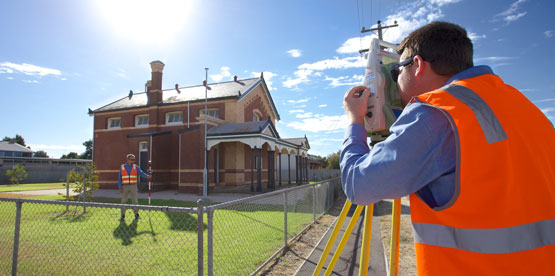
Feature surveys (also commonly referred to as site surveys or detail surveys) map the location of features and levels of your land. This can include the location of existing structures, site levels and contours, trees, vegetation and services.
Architects and engineers will need a site survey before they begin concepts and detail designs. Local Councils may also require this survey to understand how your development will affect surrounding properties. Whether you’re looking to renovate or build a new home, we can design and deliver a tailored, affordable survey solution to meet your specific requirements and goals.

We’ll put together a detailed outline of the process, estimated timeframes and costs associated with your project.

Once the quote is accepted, we’ll undertake a search of government records and for the Certificates of Title to allow us to re-establish boundaries.

We’ll conduct a survey to re-establish boundaries and locate features relating to an existing property. If required, we’ll place survey marks to show the location of your boundaries and record the re-established boundary at Land Use Victoria. We can also undertake a feature survey at this time.

We’ll perform necessary calculations and prepare 3D CAD and PDF survey plans to allow for concept and detailed designs to be completed. You will receive a boundary identification certificate, certified by a Licensed Surveyor.

If required, we can return to the site to place survey marks for construction. These could be boundary identification marks, or marks to assist with the set-out of new buildings, fences or retaining walls.

Contact our team and we’ll guide you through the entire process, from start to finish.
We are client-focused and dedicated to providing reliable, accurate data about your land. We’ll keep your project on schedule with short turnaround time and open communication.
Each project and piece of land is unique, and we tailor our services to each of our client’s needs. We’ll work with you to establish the requirements of your project early, so we can deliver great value in an efficient, seamless way.
Need advice on the boundary of your land or an accurate feature survey for planning purposes?
Contact the expert team at Ferguson Perry Surveying and discuss your needs.
Contact Us