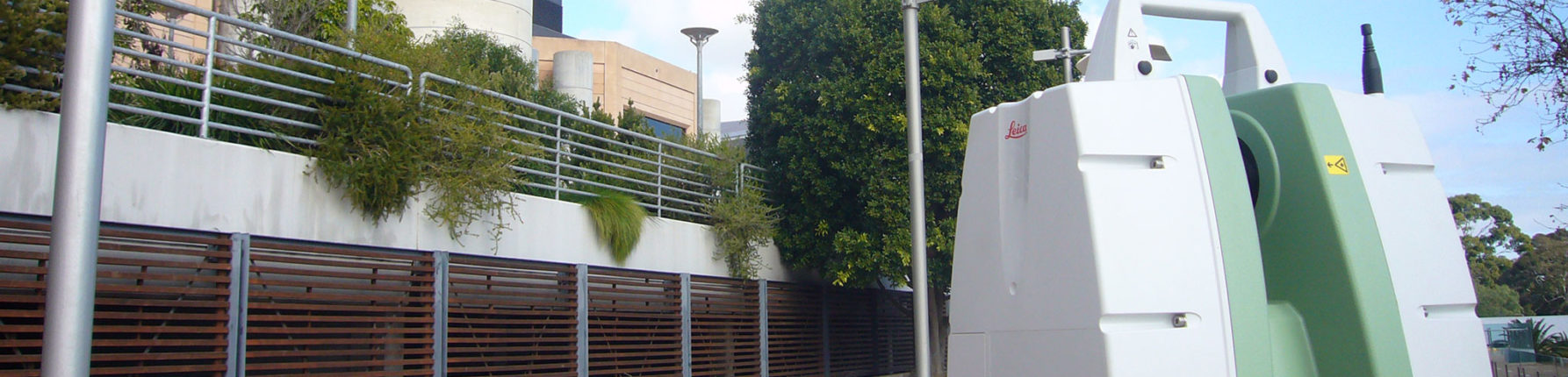
3D Laser Scanning & LIDAR
3D laser scanning offers precise, accurate and cost-effective survey results, often faster than traditional surveying methods.
3D laser scanning offers precise, accurate and cost-effective survey results, often faster than traditional surveying methods.
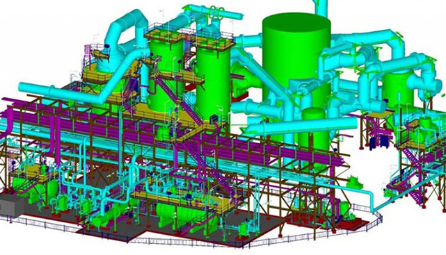
You can confidently plan, design and construct with spatially accurate point clouds of your site or structure. These point clouds can also be further developed into 3D CAD models or Revit Building Information Models.

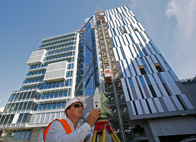
Our expert surveyors can collect precise data and create highly accurate, detailed surveys of even the most hazardous surfaces and complex structures. From rail corridors and complex industrial sites to brownfield sites and heritage buildings, we can deliver fully coloured, true 3D visualisations of the surveyed objects.

Accurate and detailed high-resolution 3D laser scanning methods allow your team to work faster and achieve more, reducing design time and project costs. Our high definition laser scanners capture site features in very fine detail and with extreme accuracy, so you can improve decision-making, reduce rework and avoid costly errors across the building and infrastructure project lifecycle.

Our TruView site means your whole team can simultaneously access, share and examine point cloud data for a range of applications without having to return to the field, saving you time and money. View your project from any angle using just your internet browser, without the need to install any specialist software.
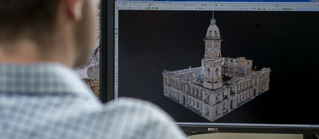
Heritage buildings often have complex surfaces or inaccessible areas that make it difficult to obtain accurate results through traditional surveying methods. 3D laser scanning is a non-intrusive and highly accurate means of capturing and cataloguing details of fragile, historical objects and structures. 3D modelling can help you to quickly and easily determine structural damage and initiate necessary repairs for heritage building preservation.
Streamline your new construction project by scanning all components as they’re installed to build a time-lapse record of the elements and materials used with millimetre precision. Use the scanned data to ensure components are correctly installed and easily catch conflicts or risks so you can adjust the designs early, instead of making costly changes later down the track.
Incomplete or inaccurate as-built surveys for an existing building can cause errors in plans and designs for future extensions and renovations. 3D laser scanning captures a structure’s form in fine detail, so the data can be converted into intelligent CAD models. This data can be used to develop extremely accurate existing condition drawings, which provides a high level of quality assurance for renovation or extension projects.
Use 3D laser scanning to find the exact location and dimensions of plant and pipework in sites where access is otherwise not possible. A 3D dimensional model of the area of interest can then be used for engineering design, allowing new elements to be manufactured without stopping production to take measurements.
See your project come to life with our 3D laser scanning and UAV photogrammetry services. Make informed decisions for your project by overlaying your concept or detailed design models on real-world coordinates.
We can deliver our high-quality, accurate 3D laser scan data from our point clouds. We will tailor our solution to your project needs, and can include 3D CAD and Revit modelling, BIM modelling, high-accuracy surface modelling and as-constructed 3D deformation modelling records.
We’ll ensure your laser scanning project is delivered as efficiently and effectively as possible.
Every project is unique, and we adapt our solutions to suit. We’ll work with you to understand your objectives, identify risks and build the best solution. Our work is certified to an international standard so you can feel confident in the results.
Innovate your next project with fast, accurate 3D laser scanning technology.
Contact the specialist team at Ferguson Perry Surveying to discuss your requirements.
Contact Us